We spent quite a few hours working to decipher the letter at our weekly radio station meetings and we have drawn a couple of conclusions.
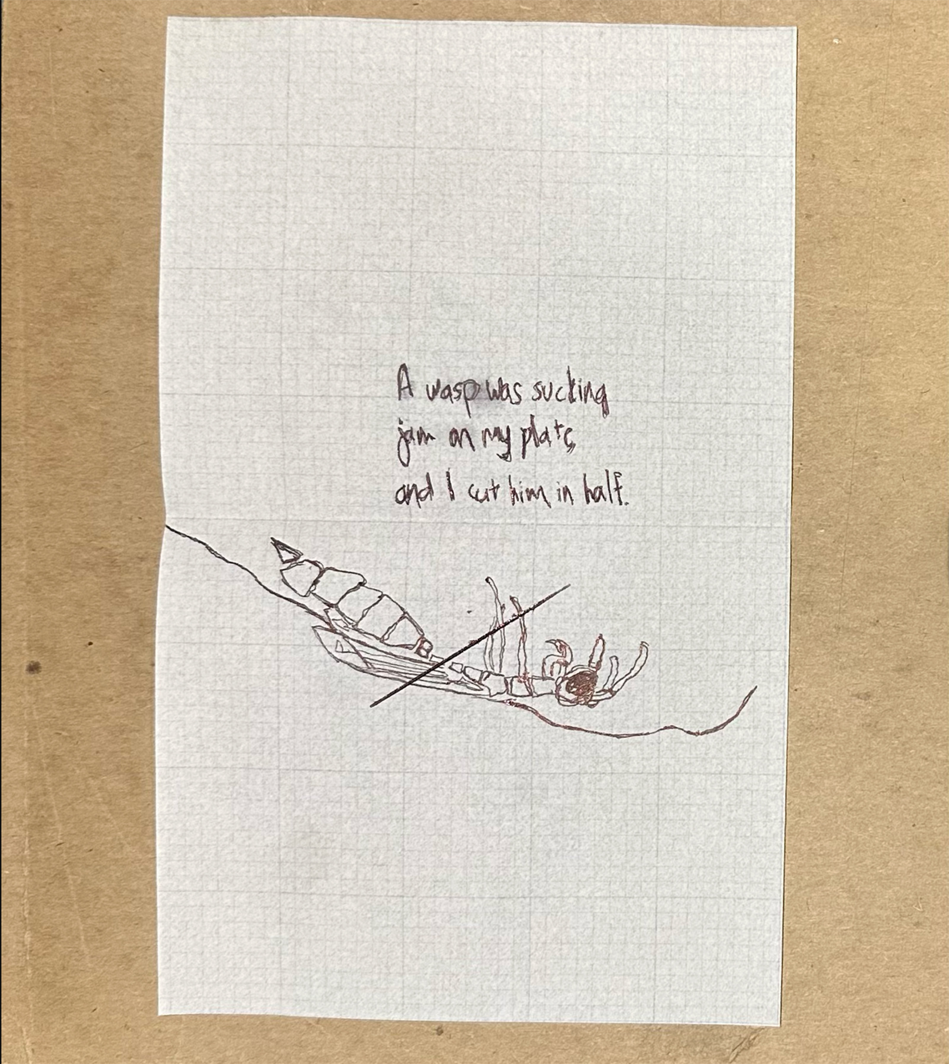
NOTE: To ensure the confidentiality of “Avid Listener,” we will not post the original letter from them on our website. However, we created a replica of it, so you can understand our process better.
Is This a Map?
Avid’s drawing of this cut-in-half wasp on its back felt completely esoteric until we (finally) realized we could be looking at a very clever note “on the way” to our destination, a map that is not meant to resemble a map, drawn by a system-impacted person who is not allowed to create, share, or mail maps to anyone. Also, the drawing is on a semi-translucent gridded vellum. So maybe this is some kind of tracing or is meant to be used as an overlay somehow.
We realized Avid’s letter is something that has probably been carried around in a pocket for a long time, longer than the time it took for Avid to contact us and then mail us. Perhaps it has been in Avid’s pocket, or someone else’s pocket, for months or years? One of our KDZU DJs is an urban cyclist and noted that the notetaking journal he keeps in his back pocket experiences the same dampness in the paper and wear and tear when cycling in Southern California’s summertime. The sweat from the body doesn’t soak the paper, but it gently permeates it, causing the it to wrinkle and making the edges wear easily. OK. So that is one mystery about the letter, possibly or possibly not at all solved. Great. We have to start somewhere I guess.
We decided that if Avid’s letter is actually a map, perhaps we could overlay it on one of our current fancier maps of the Los Angeles area to identify possible visual correlations between the two. Our goal was to match the features of Avid’s hand-drawn, psychogeographic map with a modern, high-resolution, corporate-made map, allowing us to align the two and understand any meaning Avid is trying to convery with the symbols. A best case scenario would be the symbols communicate a real place we could travel to.
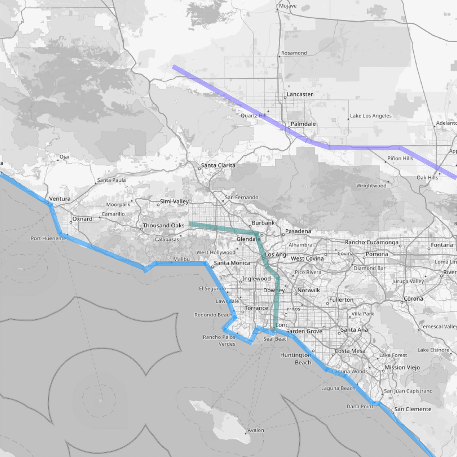
What I am describing here is the map-to-map version of the “photo-to-terrain registration” technique, also known as “photogrammetric skyline matching,” which is used to determine the position or orientation of a photograph by aligning a skyline in the photo with an actual skyline on the ground. We thought, “Why not do this with a hand-drawn map overlaid on a real map?” I suppose this is a type of analog image registration, similar to GIS but with pieces of paper instead of data in a database. Anyway, we placed Avid’s map on top of our current detailed map and moved it around, for days, but we didn’t find any matches.
We’ll keep looking.